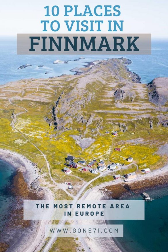
The arctic region of Finnmark is the most remote and wildest area in Europe. Yet it is fairly easy to get there and it’s a beautiful travel destination for outdoor enthusiasts, nature lovers and those who like it quite. If you want to escape the rush of your busy urban environment or are looking for the isolated post-Corona travel destination, look no further. We picked 10 great destinations for you that we totally recommend.
Finnmark is the Norwegian area of Lapland (Sápmi) and features 5 National parks and plenty of nature areas. With 1,5 inhabitants per square kilometer it is the least populated region in Europe.
If you always wanted to see a troll, this is a great opportunity. About 35 km to the North of Lakselv along the E6 to North Cape you’ll find the small Peninsula Trollholmsund in the Porsanger Fjord. The Trolls of Trollholmsund are a rock formation of Dolomitt (lime stone) and situated on a cliff 2 km outside of a small farming community at the top of the island. Make sure to follow the path or you’ll end up in one of the farm houses.
The trolls of Trolholm. photo @gone71.com
According to an old Sámi legend, some walking trolls came over the Finnmarksvidda during the night. They brought a chest full of gold and silver with them, which they wanted to burry at Porsanger. At the Porsanger-Fjord they started to dig holes but eventually failed to make them big enough so they moved on. As they came down to a headland at the sea they wanted to cross the fjord but the rising sun eventually surprised them. So they did what trolls do –they turned into stone and are still standing there well preserved until the present day. And look out for that gold! The legend says also that the treasure-chest is still standing there somewhere.
Right to the east of Trollholmsund is the little island of Trollholm that can eventually be reached by a small land bridge. Be careful though that the weather conditions are right and the tide is low otherwise you’ll get wet feet.
Kongsfjord
Kongsfjord is a small (former) fishing community in the Berlevåg municipality. If you plan a trip along the scenic road 890 to Berlevåg or Tanahorn you’ll have to pass through this little community with little over 30 permanent residents. You’ll find a coffee, a small grocery store and a guesthouse.
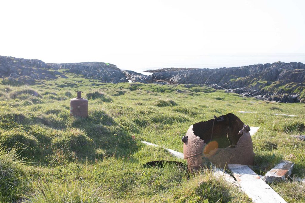
The place is one of only two remaining traditional fishing communities “væreier” that have not been burnt or bombed in Second World War in Finnmark. You can still find buildings from the time before 1940. Since the place was a strategic point in the war you can also find relicts from the war in the area.
The real gem is the Peninsula outside of Kongsfjord that invites for a little hike to its end. Only one family around three generations ago owned and inhabited this place called Veines. As the family around the fisherman Åses grew bigger the heritage was divided but the owners of the little enclave of houses on the island are still mostly related and use it mainly as summer cottages. The only guesthouse in this area is also situated here.
The surrounding mountain lakes of Kongsfjord are prime destinations to chase the mighty arctic char. Or you can decide to take off into the scenic inland wilderness of the region leaving civilization behind.
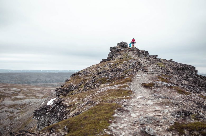
3) Tanahorn
If you drive the fjord road 890 to its end in Berlevåg you can undertake the 7,5 km (4,5 mi) round trip to Tanahorn. This is a fairly easy hike along an established trail starting about 8 km outside of Berlevåg at a small parking bay on the right. At the end of the trail you’ll be rewarded with an astonishing view from a steep cliff into the arctic sea. It is considered to have been a sacred and ritual place for the Sámi people in the past. The trek itself leads through blueberry fields up to a barren plateau to ‘the horn’. Alternatively it’s also possible to make the hike directly from Berlevåg along the coast.
The Tanahorn itself is not something special per se but the setting in the arctic landscape of the fjord and the fairly easy access makes it also a good destination with children. Maybe it you can also see it as a topping final destination to the scenic fjord-route that leads to Berlevåg. Don’t forget to stop at Kongsfjord along the road.
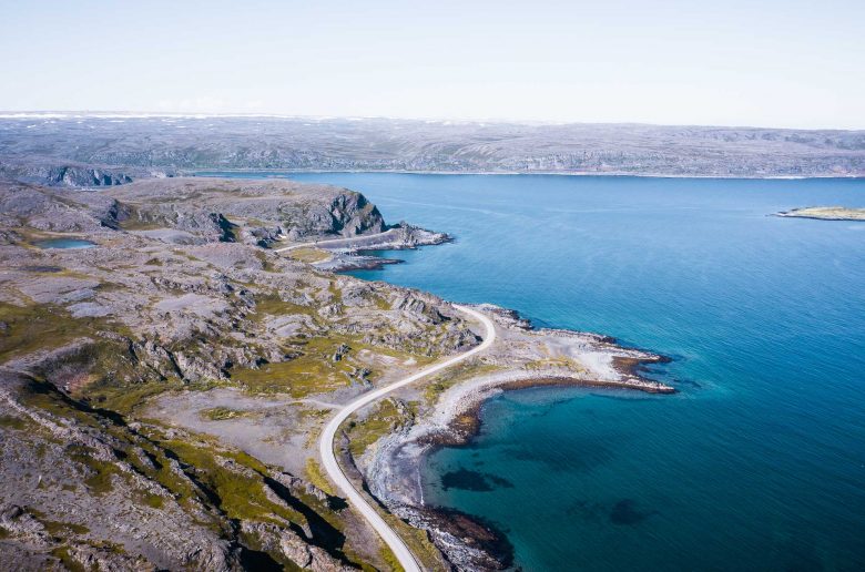
The road to Hamningberg
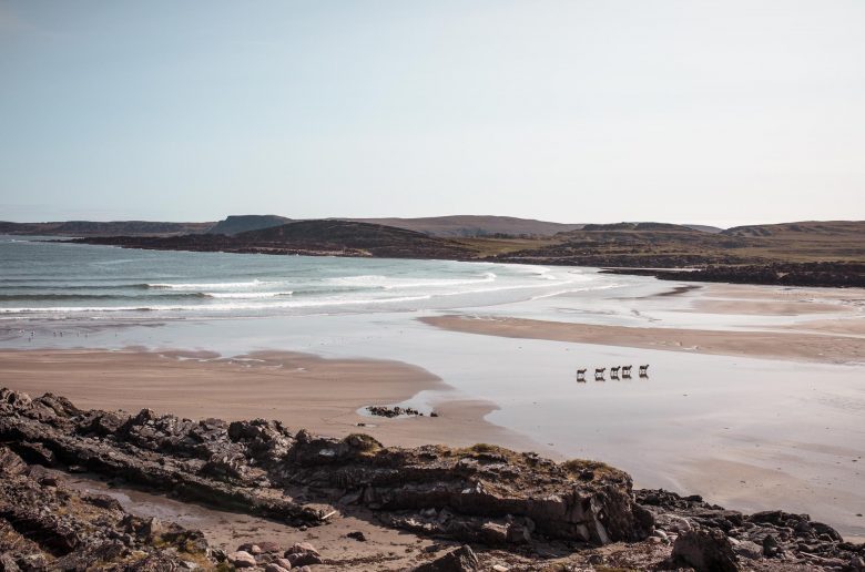
A flock of sheep roaming the sandy beach of Sandfjordneset. photo @ gone71.com
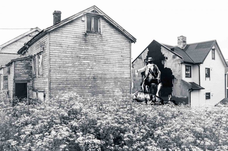
If you like it remote, the abandoned fishing village to the North-East of Vardø is the destination to go. The road along the East coast of the Varanger Peninsula gives already away some glimpses into the national park. North from Vardø, the (really) narrow road to Hamningberg features some spectacular geological formations and beautiful sandy beaches like the Sandfjordneset. You can stop literally everywhere and take right off towards the inland wilderness of the Peninsula. The road to Hamningberg is one of 18 national tourist routes in Norway. Hamningberg itself is an abandoned fishing village where you can still find some of the old blockhouses from the 19th century. In our opinion this is a good alternative to North Cape that has literally earned the title “end of the road” or “end of Europe”
You can find a nice café and restaurant there and the little village feels more like a small open air museum that you share with a hand full of tourists. From the end of the village a short but demanding trek leads to a small lighthouse. If you have a camper and do not want to stay at the caravan parking in Hamningberg you can try this (70.473485, 30.687562) place which is also a great starting point for hiking trips.
To get there by road you have to go through the city Vardø, the eastern most point in Scandinavia, and continue an other 35 km (20 mi) along a small road to the North. An interesting detail is, that Hamningberg is part of the Bøtsfjord Municipality. The small city of Bøtsfjord is situated 35 km (20 mi) to the west but in order to get there by road you have to take a 290 km (180 mi) drive around the whole peninsula. So one good option to get there would be flying in to Vadsø (a bigger city south of Vardø) and rent a car there.
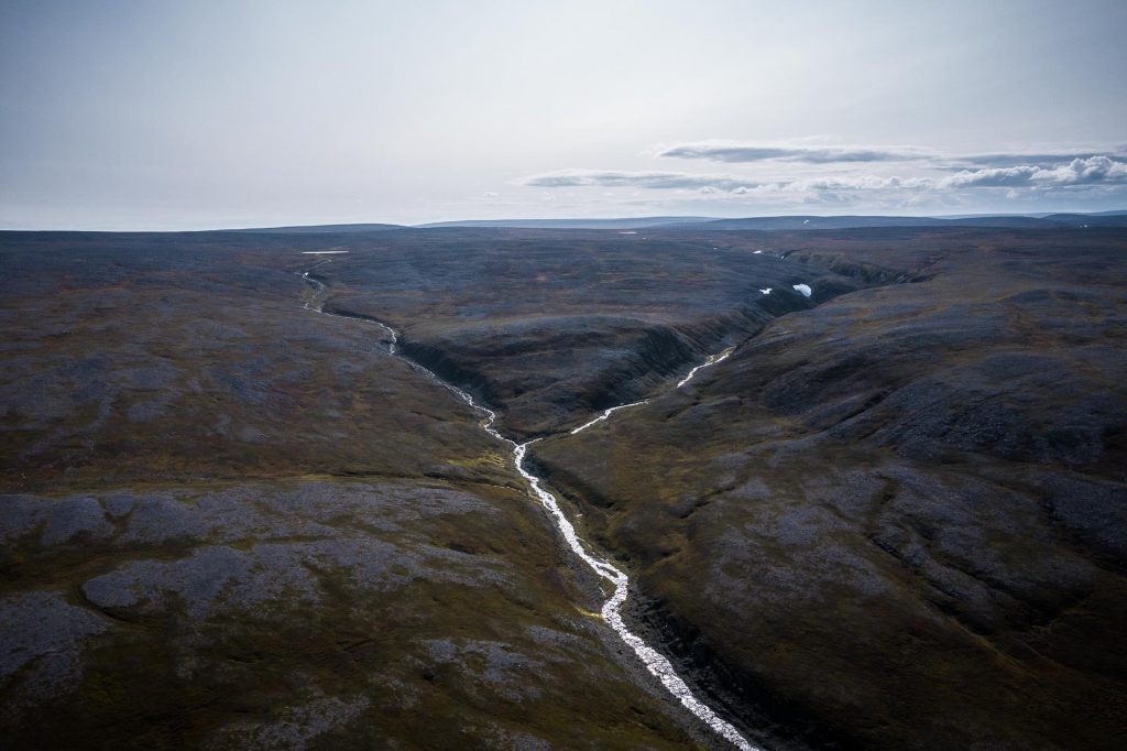
5) Øvre Pasvik National Park
A visit in the rather small national park at the boarder triangle with Finland and Russia can be considered a real wilderness adventure. It features the biggest brown bear population in Norway and if you plan your back country route carefully you can set out for a multi day adventure and cross the boarder into Finland. The distance from the last wilderness hut at the Norwegian boarder to the next (small) road (969) in Finland is app. 35 km. There are no trails or official recreational facilities. However you can find several wilderness huts on both sides of the boarder that can be used for multiple day projects.
There is a national park center located around 40 kilometer south of Kirkenes at Svanvik where you can ask all questions. Since there are no marked trails at all, a GPS is highly recommended since maps will not be very helpful in the flat forest terrain. Otherwise you might accidently end up in Russia.
It’s allowed to build a tent everywhere in the national park and you can also bring your canoe or non-motorized boat. Fishing is allowed if you acquire a license. For wilderness huts and shelters we recommend our shelter guides:
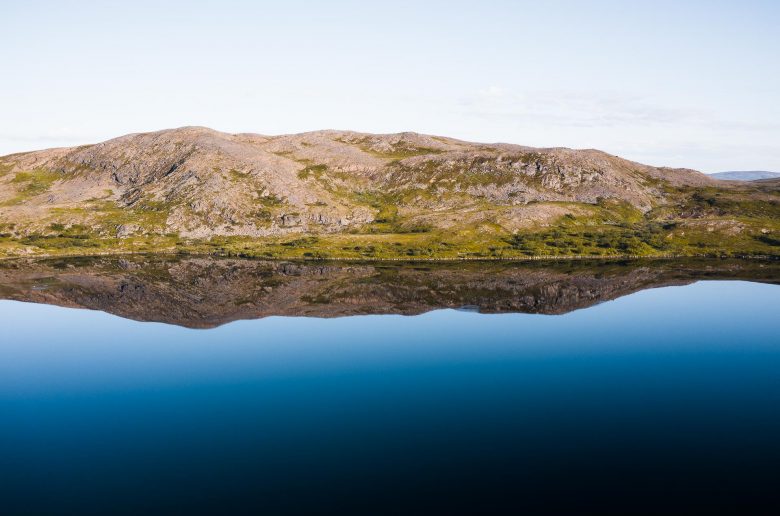
A look into the northern parts of the Varanger Peninsula Natinal Park. photo @ gone71.com
This fairly new national park was established only in 2006 and preserves most of the real arctic area in Norway. It’s the land of the endangered arctic fox and the wolverine. The tundra landscape here has more distinct features with more influence from the east and is of a gentle wildness. Make no mistake though, conditions can be very rough at this latitude so planning and equipment is key for bigger endeavors.
The terrain is mostly moors, lakes and marshes and fairly easy to navigate. However, with 2000 km2 there is still enough room to get lost. In higher altitudes the vegetation gives way to bare rock and flagstones.
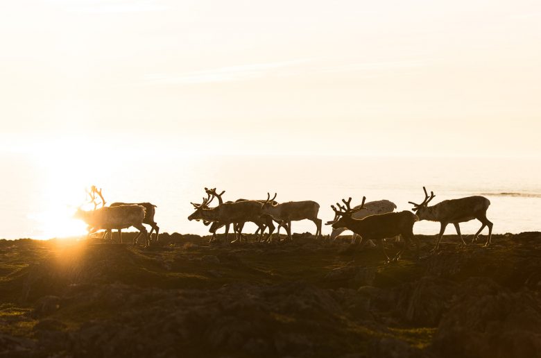
For centuries the whole area was an integral part of the Sámi reindeer herding culture and they are still pursuing their trade within the boundaries of the national park. If you are looking for a reindeer antler this is a fairly good place to start.
There are several entrance points along the route and shorter hikes are signposted. The long option is to cross the Varanger Peninsula by foot.
Komagdalen (183190, 30.189063): a short drive from the E75 near Komagvaerstranda. It’s a small gravel road leading about 7 km inland to a parking lot. There are alos easy options for dayhikes. There is a 10 km bird watching trail suitable also for children.
Nattfjelldalen (105757, 29.828934): This is the Southern entry point close to Vadsø. In order to get there simply follow the signs to “Skytebane and Crossbane” and follow this road for 1,5 kilometers. Then turn left and follow the road for an other 3 kilometers to a parking area. You’ll pass the lake Byvannet to your left on this last section. You can make an 18 km roundtrip to the end of the Natfjell valley from there.
Ordo (491041, 29.247845): Alternatively you can enter the National Park via the route to 891 to Båtsfjord. Turn right and follow the rather bumpy road to the Ordo lake and start from there.
There are several wilderness huts that you can use when you are crossing the Peninsula. Maps are available at the tourist offices e.g. in Vadsø. You can find the names and locations of the huts in our Norwegian shelter guide.
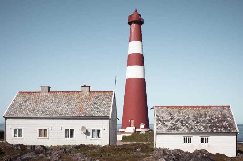
Branded as the northern most mainland lighthouse in the world Slettnes Fyr is a great destination for those who are looking for something with easy access. It’s situated only some kilometers outside of Gamvik on the wild arctic coast of the Barents Sea. If you have decided to skip North Cape but still want to tell that story of “northern most” that might be a consultation.
Even though you’ll for sure meet fellow travellers, the place is not too crowded. The lighthouse itself can be visited with a guided tour. In the end it is what it is, a nice lighthouse featuring a lovely little café in one of its buildings.
The more interesting thing to do here is the fairly easy 6km hike starting about one kilometre to the west at the end of a small road (71.090745, 28.188509). This hike leads you along a marked trail through the beautiful scenery of the small nature reserve. There is also a bird watching shelter and along the way are information points about an old and long gone fishing settlement. Even though it is possible to get at least to Gamvik with public transport and plane or boat via Mehamn but it’s probably not the effort if it is the only thing you want to do in this region. So, the realistic option is still by car or motorbike and you can always make it a side trip if you go to Mehamn. If you have a camper you can park it directly where the hiking trail starts and stay there for one night. It’s more quite and scenic then in front of the lighthouse.
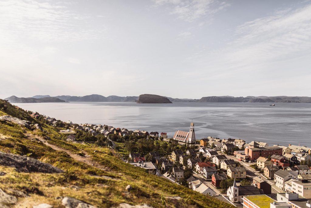
Is it worth a visit? We say it depends! Hammerfest is one of the Northern most cities in the whole world and has definitely its charm. You will find small streets, the harbor and seaside flair, classic and colorful wooden houses and touristic infrastructure – all while surrounded by nature. There are several hikes you can undertake directly from the city and if you are travelling in Finnmark anyway and feel the need for some social interaction this is a good opportunity. There are museums like the Museum of Reconstruction and of course the recommended visit at the Royal and Ancient Polar Bear society. The latter is free of charge and highlights the arctic wildlife – foremost the polar bear – and traditional ways of hunting. For a small membership fee (220 NOK) you can call yourself a “Member of the Royal and Ancient Polar Bear Society” – certificate and stylish sticker for your vehicle included.
Hammerfest is a former fishing town that turned into a gas mining hot spot and the business is omnipresent. If you come by camper, the upside is, that you can find some of the cheapest gas stations in Norway. We would definitely recommend to climb the nearby hill behind the city for a spectacular overview. Alternatively you can also climb mount Tyven for an even more scenic encounter.
Brattneset in Forsøl near Hammerfest. A scenic and easy destination. photo @ gone71.com
Our insider recommendation is to drive (hike) the 10 km to the end of the road in Forsøl and stroll around at Brattneset (70.719475, 23.830322) or hang out at the beautiful sandy beach. This is also a very suitable and quiet destination for an overnight stay in a camper or a tent.
9) Karasjok
If you are interested in Sámi culture this one should be on your list. Karasjok is one of the Sámi centers of Lapland and accommodates not only the Sámi National Museum but also the Sámi Parliament. The fairly new building of the Sámi parliament is open to visitors and we recommend participating in a guided tour to get better insights in the history and political structure. Furthermore you’ll find a lot of Sámi related shops and handicraft as well as guided activities. Sámi culture is a big business here and during the more busy summer months you’ll meet most certainly a lot of other tourists.
10) Alta
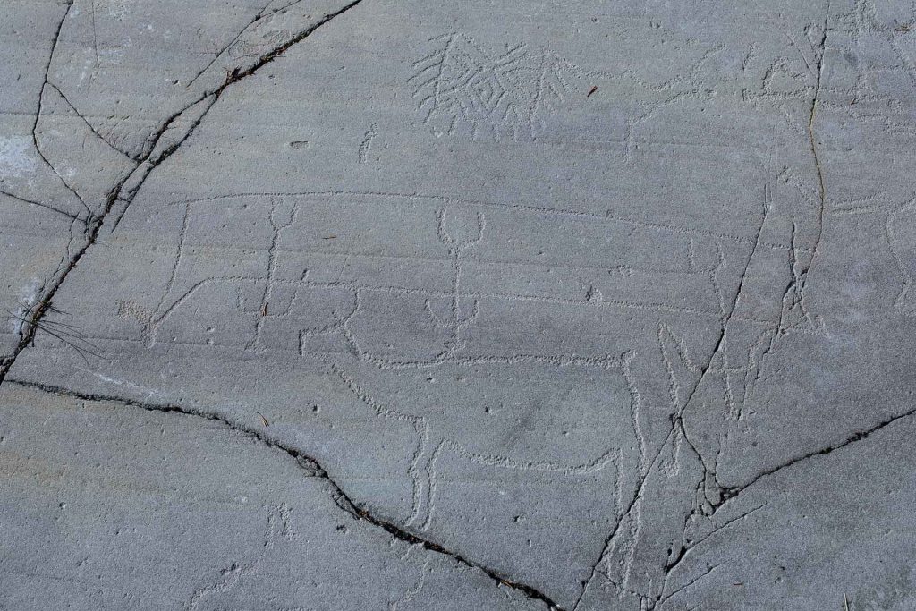
This destination is not so much about the city itself but about the surroundings. The best known destination in Alta is the Alta Museum (World Heritage Rock Art Centre) featuring the famous rock carvings of the area. The UNESCO world heritage is home to 3,000 carved figures. Situated 4 km out of the city center, it is one of the biggest attractions in the whole Troms og Finnmark region. If you want to learn more about local culture and its development this is a good choice.
Enthusiastic Nature lovers can undertake a fantastic day adventure in the Alta canyon. This hiking destination starts about 30 km to the South of the city 4 km past the village of Gargia at a parking lot (69.780027, 23.557588). Be advised that the last part of the road from Gargia can be a bit rough. The hike to the Canyon itself is fairly easy and will take you around 3 hours for a round trip. It’s a very remote place and invites for an overnight stay in a tent or in your camper near the car park. Alternatively you can also book a guided tour for this destination.