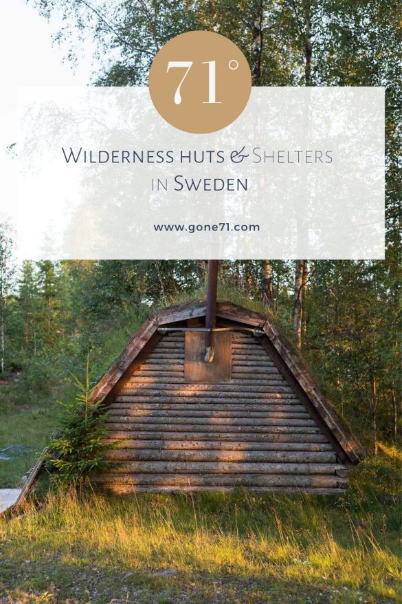

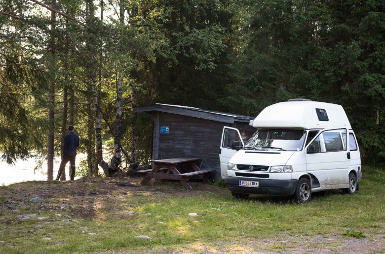
Sweden has a big range of wilderness shelters throughout the country, some basic to primitive others very elaborated and suitable for the worst conditions. If you plan your trip carefully you can even leave your tent at home.
Similar to Finland there are thousands of shelters for the public to access. Usually you will also find an open fireplace and in many cases also firewood. Shelters in Sweden are basically divided in two main categories, vindskydd and raststugor.
Vindskydd
- (lean-to shelter) is the most common type of shelter you will encounter. The literal translation of the word means wind protection or shelter. Usually they are a semi-closed structure that is open to one side usually with a fireplace in front of the opening. They are the same as the Finnish laavus and can be divided into two main categories. Vindskydd med sittplatts (shelter wit seats) are protective resting place for short-term use normally equipped with a bench or a similar sitting possibility. They are meant as protective measurement for hikers, hunters or during fishing trips. Vindskydd med sovplats (shelter with sleeping space) are very similar but feature normally at least a wooden floor or platform to spend the night if you bring your sleeping bag and sleeping pad.
Raststugor
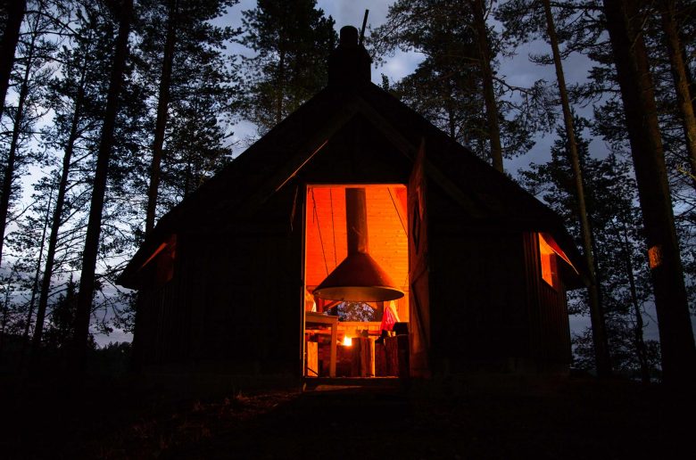
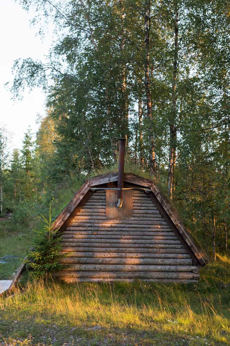
- (day- or wilderness hut) includes everything that counts as a closed shelter and the meaning of the term includes everything from a lapp-hut style building to a classic wooden bloc house. They have a fireplace or oven and are often provided with fire wood and a dry toilet close bye. Some are also provided with bunk beds or a sleeping platform but the majority is built as day huts and provide only sitting possibilities.
Most of the shelters are maintained and owned by local communities and associations e.g. for fishing, hunting, bird watching or simple resting places along hiking trails and rivers.

- For detailed information about shelters in the North read:
The guide to wilderness huts and shelters in the North - For detailed information about camping in the North read:
Camping in Scandinavia and Finland
How to find shelters and wilderness huts in Sweden
An easy way to identify shelters in the area of your interest in Sweden is to look for them online. Fortunately someone took the time and effort to provide you with some details. There are basically two services that you might find useful. One is the Vindskyddskartan and the other one is the “Naturkarta”.
Vindskyddkartan Sverige (Swedish shelter map)
One great way to identify shelters in Sweden is the ‘Vindskydd’ map, a collection that features currently around short over 3000 entries for various types of shelters. The content is user generated and even though you can not take all the entries for granted, it gives you a great overview of potential shelters close bye. The content is constantly updated and there is even a big (closed) Facebook group that provides constantly actual entries and information.
The project has pr3eviously moved from google mymaps to a new and much more userfriendly site. This is a great improvement and you can find currently over 3500 entries on www.campwild.org
The facebook group is mainly in swedish but the new website provides information also in English. An other huge improvement to the previous version. The service is not as expansive as the Finnish services but it will give you useful insights for your next trip.
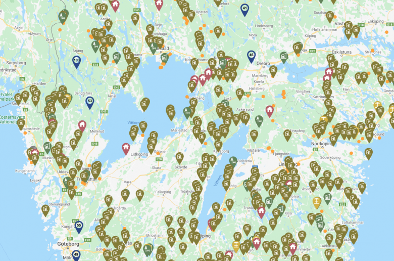
The realy great feature here is that you can download all entries as a .gpx file to integrate it into your own gps device or mapping service of choice.
Shelters I Sydsverige (Shelters in Southern Sweden)
In addition there is also a minor collection of around 200 shelters solely for the South of Sweden. Not all of the shelters provided are covered by the vindskyddkartan so you might want to look there too if you plan to stay mainly in the South.
UPDATE: This service is currently unavailable and it seems the founder has decided to put the actual map behind a paywall. The service claims now to provide arround 400+ entries for Southern Sweden. Since there are other services out there that provide similar data we do no longer recommend this service.
Find more inspiration in some of our other poster designs
↓↓↓
Naturkartan (nature map)
This is a free to use web service (www.naturkartan.se) and also mobile app that features a map where you can filter everything from fireplaces over shelters and huts to toilets. The map can also be used to show you popular hiking trails, fishing spots and pretty much everything else you can think of. This is a great all-round application especially if you plan to stay in popular hiking areas or along established hiking trails. The Service is provided in German and English but in depth information are in Swedish. The navigation on the mobile app is straightforward with self-speaking icons.
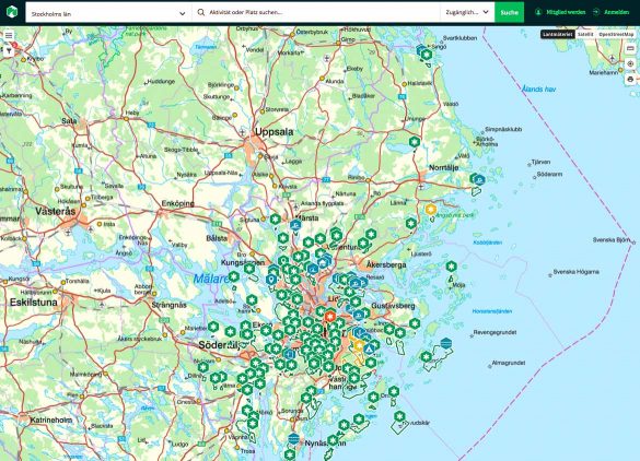
The map can be filtered by region or show the whole country. At time of writing there are around 430 shelters and 190 open huts registered. There are also around 1400 mapped fireplaces and about the same number of resting places mapped across the country and some of these facilities probably also qualify as basic shelters.
For most mapped places there are further information and images provided. So you can get a pretty good idea of a place even if you do not understand any Swedish.
Other things to consider when looking for shelters in Sweden
- Be aware that Vindskyddskartan Sverige is no official service and that you cannot take their services as totally accurate. In some cases it can be that day huts or shelters are locked, damaged or not even existing on the position they are supposed to be. Keep that in mind when planning your trip so you do not get yourself in trouble.
- You should also be aware that many places are built by local communities or associations e.g. as fishing shelters. Mainly locals who know where to find them use these shelters and there are usually no official signs that prompt you in the right direction. Treat these facilities with respect and be grateful that you are allowed to use them.
- Don’t be shy to ask some locals for help. You might be surprised how friendly and helpful they will be if you make the first step towards them.
- A detailed analog hiking map is always a recommended thing if you prepare for more extensive adventures. Some wilderness huts are so far off that a compass and a map are the minimum requirements to reach them.
- You can always ask in tourist centers for detailed information on various topics.
- Let your intuition guide you. If you have no idea where to look for it is always a good start to watch out along rivers or lakes since a huge part of them are built for fishing purposes close to the water.
- Use all facilities that you encounter with greatest respect and don’t take these excellent services for granted. We have first hand witnessed instances where shelters where closed permanently due to misbehavior of individuals in various places of Scandinavia. So take that very serious to give others the chance to take advantage of these excellent facilities too.
- Don’t leave any trash behind if there is no designated place for it.
- Always follow the rules and guidelines and treat other visitors with respect. To be first on a spot does not mean that you have special privileges.
Be aware that it is absolutely forbidden to make an open fire during a forest fire alarm. This includes all fireplaces that are not in a closed shelter. One spark is enough to light up a whole forest, so act responsible.

Shelters and wilderness huts in other northern
- Finland: Find wilderness huts and shelters in Finland
- Norway: Find free wilderness huts and shelters in Norway
- Denmark: Find free shelters in Denmar