
The North Cape is one of these places, which are cloaked by an adventures or even mythical touch that constantly whispers – come and visit me. And than there are these loud rumours that most have at least vaguely heard of, that it is a crowded tourist trap, that it is a boring pile of rocks, nothing to see at all, that it is very expensive and always covered in fog anyway.
We are sorry to break it to you but the rumours are mostly true. North Cape is a construction of the tourist industry dating back at least to the 18th and 19th century where it was surely a true adventure to undertake the journey to the ‘end of Europe’. However the 307 meter (1007 ft) high cliff is not even the real thing that it promises to be.
Here are some facts to deconstruct the myth: Around 4 km (2,5 mi) to the Northwest is the neighbouring point, Knivskjellodden which is actually 1450 meters (4750ft) further north. Personally we think it is a bit grotesque how everyone ignores this fact. Even the official certificate (that you pay for of course) states that you have reached the Northern most point of Europe. But since Knivskjellodden is not accessible by car, is an 18 km round-trip (through scenic landscape!) and has not quite that catchy name, no one wants to hear about it.
And then there is also the thing with the tunnel – a 6,8 km (5 mi) tunnel that connects mainland
Europe with the island Magerøya where the North Cape is located. So the actual Northern most point of mainland Europe for purists is Cape Nordkinn (Kinnarodden) about 70 km (43 mi) to the east and 5,7 km (3,5 mi) to the South near the Town Mehamn. It might seem as a picky
detail but if we mention islands there is always this inhabited lump of ice Spitsbergen with its northern most point Rossøya, at 80°49′44.41″ N as well.
About 200,000 people each year making the touristic pilgrimage to the Northern most point of Europe. And summer is short 71° North, which leaves the horde around a three month window to accomplish their task. Pretty much the only reason why people go there is to tell themselves and others that they have been there. Make a selfie, post it on instagram #northcape and everyone will admire your bravery and hunger for adventure. Or not. That is not necessary a bad thing if it satisfies your needs and if you just want to have THAT certificate that says ‘been there, done that’ for your living room, don’t hesitate and go.
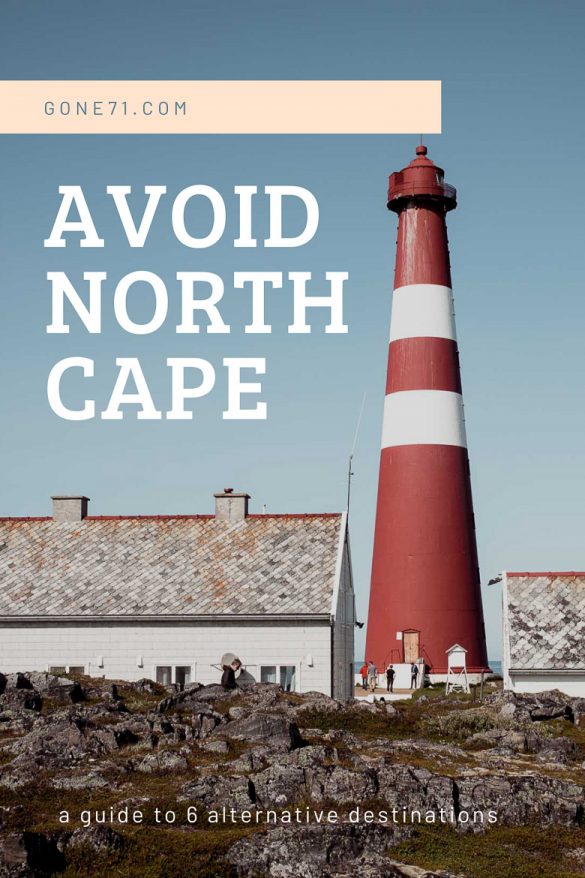
For those of you who are more interested in different values, the real thing or simply some privacy in beautiful scenery at the same latitude we will offer 6 alternatives.
Knivskjellodden – the real North Cape
Don’t be intimidated by this myth busting facts. Mageøya itself is a beautiful place and if you want to check that North Cape experience on your bucket list you should still go but we suggest you walk the extra mile (or 11 in this case) and do it properly.
The good thing is, that you are wandering now the land of the midnight sun which means you have luckily plenty if not always daylight. The sun stays above the horizon until the 2nd of August at this latitude. The 18 km hike takes around 6 hours and is marked with cairns all along. The way starts around 25 km (15 mi) North of Honningsvøg – the signs of the starting point can hardly be missed. Just make sure that you are there when the snow is gone or otherwise you might find it impossible getting along. The landscape is scenic and you’ll find yourself mostly alone on your journey. The hike itself is no big challenge if you have the endurance. Make sure to be properly equipped for changing weather conditions and have enough water. The endpoint is marked with an obelisk at 71 degrees 11 minutes 8 seconds N. One end of Europe.
Cape Nordkinn – the real North
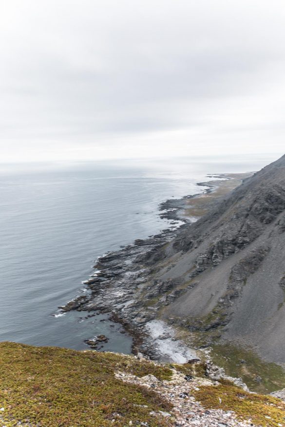
Now, the (athletic) purists amongst you might want to consider the real Northern most point of European mainland – Cape Nordkinn (Kinnarodden) on the Nordkinn peninsula. This is pretty much the antithesis to North Cape when it comes to popularity and visitor frequency. It’s an impressive place that takes its toll to get there by foot. There is also the option of a boat trip too for around 550 NOK or a boat pick up if you want to hike only one way and can be easily arranged in Mehamn.
The 23 km (15 mi) trip (one way!) leads through harsh stony terrain (no trail) through rock fields and is considered demanding and difficult. It is only marked by rather sparse cairns or the one or other pole. If you like adventure that one might just be for you. Calculate a minimum of two days (some advice even more) and prepare properly. It’s a stone desert! Depending on your style you should consider tent, sleeping bag, compass, map, GPS, stove… You can get a map with GPS points in Mehamn (Red Tree).
The trip starts close to the Mehamn airport at a huge portal that marks the beginning of the walk and most of the way is pretty rough. The Cape itself is set in a wild and extreme arctic nature that can be beautifully romantic but also brutally harsh and dangerous if the weather is bad, especially in rainy conditions. The area is also well known for its dens fogs where orientation gets close to impossible without GPS. You’ll have mobile phone coverage most of the way though. So plan your trip carefully and check weather conditions in advance.
There are several ways to get to Mehamn. In the best case scenario you have plenty of time and a car or even a camper and make all the way up Scandinavia by yourself. If you are depending on public transports you can take a bus from most cities in Finnmark but it will take some time due to long distances and you have to get to the North first. An other popular way to travel to Mehamn is with Hurtigruten, a special and famous ferry service in Norway that docks twice a day. Yet, the easiest way to get to Mehamn is by airplane with normally 4 arrivals/departures a day – not cheap though. If you are well prepared and equipped you could even walk out of the gates and start hiking right away. Alternatively you can fly to Tromsø or also Vadsø, take a rental car or bus and drive some hundred of kilometres through scenic landscapes.
Tanahorn – the easy and beautiful
If you drive up the Tanafjord all the way to Berlevåg you should consider Tanahorn. As most of the fjord routes the road there itself is an astonishing experience and one of our favourites. The Tanahorn is a cliff with an astonishing view into the arctic sea. It is considered to have been a sacred and ritual place for the Sámi people in the past. The hike to Tanahorn is easy and starts around 8 km west from Berlevåg at a small parking bay on the right. It leads through blueberry fields up a barren plateau to ‘the horn’ itself where you will be rewarded with a dramatic landscape. The hike itself is a 7,5 km (4,5 mi) round trip with app. 250 m (800ft) of elevation to come bye.
Alternatively you can also take the hike directly from the centre of Berlevåg along the coast if you do not have a car. You can get to Berlevåg by almost all means of transportation and even fly in directly to the small airport. Taking the trip via the long road through the Tanafjord will be more rewarding and features amongst others excellent fishing grounds for arctic char along the way. Also check out Kongsfjord and the lovely sandy beaches there.
Lorem ipsum dolor sit amet, consectetur adipiscing elit. Ut elit tellus, luctus nec ullamcorper mattis, pulvinar dapibus leo.
Slettnes Fyr – the northernmost mainland lighthouse worldwide
If you are looking for something with a bit more easy access Slettnes Fyr is a great option. The lighthouse is branded as the northern most mainland lighthouse in the world and situated just some kilometres North of Gamvik. If you have decided to skip North Cape but still want to tell that story of “northern most” that might be a consultation.
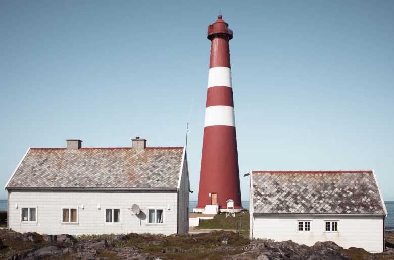
Even though you’ll for sure meet fellow travellers, the place is not too crowded. The lighthouse itself can be visited with a guided tour. In the end it is what it is, a nice lighthouse featuring a lovely little café in one of its buildings.
The more interesting thing to do here is the fairly easy 6km hike starting about one kilometre to the west at the end of a small road (71.090745, 28.188509). This hike leads you along a marked trail through the beautiful scenery of the small nature reserve. There is also a bird watching shelter and along the way are information points about an old and long gone fishing settlement.
Even though it is possible to get at least to Gamivk with public transport and plane or boat via Mehamn but it’s probably not the effort if it is the only thing you want to do in this region. So, the realistic option is still by car or motorbike and you can always make itt a siedetrip if you go to Mehamn. If you have a camper you can park it directly where the hiking trail starts and stay there for one night. It’s more quite and scenic then in front of the lighthouse.
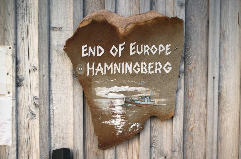
Hamningberg is an abandoned fishing village where you can still find some of the old block houses from the 19th century. If you are looking for the real end of the road in Europe this is the place to be in the North.
You can find a nice café and restaurant there and the little village feels more like a small open air museum that you share with a hand full of tourists. From the end of the village a short but demanding trek leads to a small lighthouse. The real gem though is the beautiful landscape the road to Hamningberg is set in. There are various beautiful spots and sandy beaches as the Sandfjordneset that are worth a visit. Or you can simply stop along the road and start hiking into the wild into the Varanger national park. Chances are pretty good that you’ll meet no one but reindeer and arctic foxes. If you have a camper and do not want to stay at the caravan parking in Hamningberg you can try this (70.473485, 30.687562) place which is also a great starting point for hiking trips.
To get there by road you have to go through the city Vardø, the eastern most point in Scandinavia, and continue an other 35 km (20 mi) along a small road to the North. An interesting detail is, that Hamningberg is part of the Bøtsfjord Municipality. The small city of Bøtsfjord is situated 35 km (20 mi) to the west but in order to get there by road you have to take a 290 km (180 mi) drive around the whole peninsula. So one good option to get there would be flying in to Vadsø (a bigger city south of Vardø) and rent a car there.
Havøjsund – the alternative route
If you have a caravan, a car or if you make that bike trip to the north, there is one last big crossroad at Olderfjord before you are pretty much committed to go all the way up. All tourists who travel to North Cap have to come through here and if you make a break at the Olderfjord Tourist Center (hotel) you might get a very good idea of who is heading in the same direction as you do. If you came all the way to this point and decide to prefer something more quite without committing to the extensive hike to Knivskjellodden you should consider heading to Havøjsund instead.
This little fishing community is set on the mainland around 45 km to the east and 15 km to the south of North Cape but already 71° North. You’ll find an authentic fishing community at the end of the scenic mainroad without all the busy hustle that you encounter along the actual North Cape route. To get there simply leave the main road to North Cape around 3,5 km (2 mi) at Smøfjord and turn left on the road number 889. From there it is an 85 km (52 mi) drive.
You can continue the small and bumpy road from the main village for about 5 more kilometers to the Arctic View café and restaurant. You should go there in any case even if you do not plan to consume anything. The view on the Arctic Ocean is breathtaking. Simply follow the road towards the windmills that are scattered across the mountaintop until you arrive at a big parking place.